

Satellite monitoring data show that Indonesia’s burned area from January to September 2026 was approximately 38% higher than during the same period in 2019, while hotspot numbers increased by 63%, with September accounting for nearly half of the total.
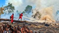
PALMOILMAGAZINE, JAKARTA, INDONESIA — Indonesia’s forest and land fires (karhutla) during January–September 2026 have surpassed the levels recorded during the same period in 2019, according to monitoring data from Nusantara Atlas. The platform estimates that approximately 1.9 million hectares of land had been affected by fires, accompanied by a significant increase in detected hotspots.
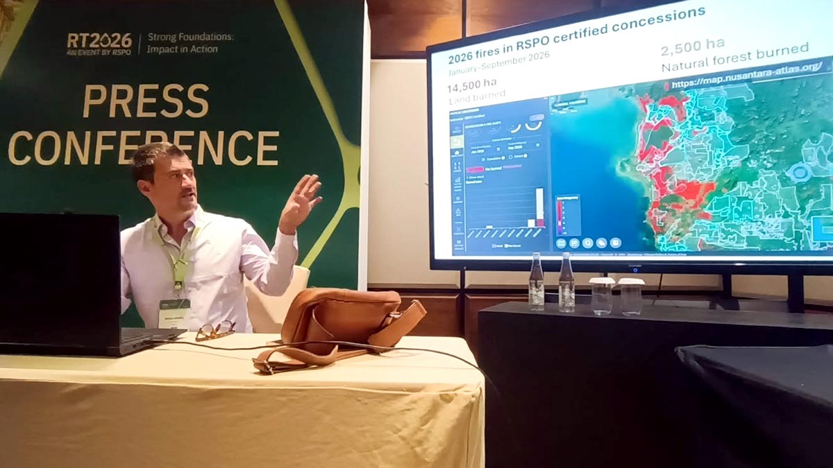
David Gaveau, Founder of The TreeMap and developer of the Nusantara Atlas platform, said the latest monitoring data showed that the number of hotspots in 2026 was 63% higher than during the corresponding period in 2019. The total burned area also increased by approximately 38%.
Also Read: RSPO Strengthens Fire Monitoring in Indonesia with Satellite Data and Independent Audits
Gaveau presented the findings during a briefing on Indonesia’s fire situation at the RSPO Roundtable Conference 2026 (RT2026), attended by PalmOilMagazine on Tuesday (Nov. 3, 2026).
He explained that Nusantara Atlas updates its monitoring data monthly, generally around the 10th of the following month. Burned-area mapping uses imagery from Europe’s Sentinel-2 satellite system, which captures the Earth’s surface, including Indonesia, every two to five days.
“The data we are presenting show that fires this year are more extensive than in 2019,” Gaveau said.
Also Read: RSPO Upholds Accountability while Addressing Indonesia’s Fire Crisis at RT2026
The comparison is particularly significant because 2019 was one of Indonesia’s major fire years, with the total burned area exceeding 2.6 million hectares by December. However, Gaveau noted that the monitoring system presented in the briefing did not yet provide a historical comparison covering the period since 2015, meaning the longer-term assessment remains limited.
September Accounts for Nearly Half of 2026 Burned Area
Monthly monitoring data identified September 2026 as the most severely affected period, with slightly more than 1 million hectares burned. This represented nearly half of the total burned area recorded between January and September.
Nusantara Atlas also classified the affected areas according to land cover. Approximately 35% of the burned area was associated with swamp vegetation. Savanna and grassland areas were also affected, particularly in regions experiencing pronounced dry-season conditions.
Also Read: Belayan Sejahtera Cooperative Mobilises Independent Smallholders to Prevent and Fight Forest Fires
For natural forest areas, an analysis using the Ministry of Forestry’s baseline map identified approximately 88,000 hectares affected by fires, equivalent to around 4.6% of the total burned area.
Using an alternative baseline map developed by Nusantara Atlas, the estimated burned natural forest area was approximately 85,000 hectares.
Gaveau explained that differences in mapping results can arise from the underlying datasets and land-cover classifications applied. He also stressed the importance of distinguishing between satellite-detected burned areas and actual vegetation conditions on the ground, as satellite pixels classified as burned may still contain some surviving vegetation.
Also Read: Jambi FFB Prices Reach IDR 3,717.77/kg for 10–20-Year-Old Palms
Palm Oil Concessions Among Areas Affected by Fires
Nusantara Atlas also examined the distribution of burned areas across different land-use categories, including plantation concessions.
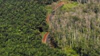
The analysis identified hundreds of thousands of hectares of burned land within oil palm plantation concession boundaries, representing approximately 11% of the total burned area mapped by the platform. Of this area, around 19,000 hectares were classified as forest areas located within oil palm concession boundaries.
Gaveau emphasized that the distinction is important because not all land within an oil palm plantation concession has necessarily been planted with oil palm. Some concession areas may still contain forest or other land-cover types.
Similar assessments were conducted across mining concessions, land-use rights (Hak Guna Usaha or HGU) areas, forestry concessions, logging concessions, and other concession categories.
The presentation showed that the proportion of burned areas varied across these land-use categories, reaching approximately 8.5% in mining concessions, 6.4% in HGU areas, 6% in forestry concessions, 2.5% in logging concessions, and 2% in other concession categories.
Also Read: Indonesia Cuts November 2026 CPO Reference Price 6.07% to US$978.90/MT, Sets Export Duty at US$124
These figures provide an overview of how fires are distributed in relation to land-use and concession boundaries. However, the presence of burned land within a particular concession does not, by itself, establish responsibility for the fires. Determining the cause and assigning liability require further investigation and verification.
Satellite Data to Strengthen Fire Monitoring
Nusantara Atlas provides interactive access to its monitoring data through an online platform. According to Gaveau, users can register to access the system and examine the distribution of fire-affected areas in greater detail.
The satellite-based monitoring system is expected to help industry stakeholders, policymakers, researchers, and civil society organisations better understand the scale and distribution of Indonesia’s forest and land fires.
For the palm oil industry, the findings also highlight the importance of strengthening fire prevention, monitoring, and land-management practices, particularly in areas surrounding plantation concessions.
By providing regularly updated satellite observations and spatial data, Nusantara Atlas aims to support more transparent monitoring and contribute to broader efforts to prevent and manage forest and land fires across Indonesia. (P3)